


 à la route d'îlet à Cordes par le col du Taïbit. - Photo 21")
 à la route d'îlet à Cordes par le col du Taïbit. - Photo 22")
 à la route d'îlet à Cordes par le col du Taïbit. - Photo 23")
 à la route d'îlet à Cordes par le col du Taïbit. - Photo 24")
 à la route d'îlet à Cordes par le col du Taïbit. - Photo 25")
 à la route d'îlet à Cordes par le col du Taïbit. - Photo 26")
 à la route d'îlet à Cordes par le col du Taïbit. - Photo 27")
 à la route d'îlet à Cordes par le col du Taïbit. - Photo 28")
 à la route d'îlet à Cordes par le col du Taïbit. - Photo 29")
 à la route d'îlet à Cordes par le col du Taïbit. - Photo 30")
 à la route d'îlet à Cordes par le col du Taïbit. - Photo 31")
 à la route d'îlet à Cordes par le col du Taïbit. - Photo 32")

6.2 km | 15.8 km-effort

User


FREE GPS app for hiking
 SityTrail
IGN / Geographical institutes
SityTrail World
The world is yours!
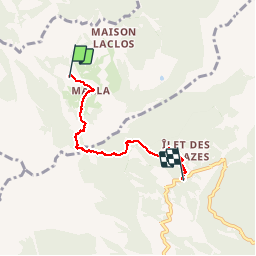
Trail Walking of 5.9 km to be discovered at Réunion, Unknown, La Possession. This trail is proposed by olive2b.
Retour moins dur que l'aller. Ne pas tenir compte de la durée. Pauses photos et boissons sont comprises dedans. Un petit arrêt à l'îlet des Salazes pour boire une petite tisane préparée par l'Association des Trois Salazes.
 à la route d'îlet à Cordes par le col du Taïbit. - Photo 1")
 à la route d'îlet à Cordes par le col du Taïbit. - Photo 2")
 à la route d'îlet à Cordes par le col du Taïbit. - Photo 3")
 à la route d'îlet à Cordes par le col du Taïbit. - Photo 4")
 à la route d'îlet à Cordes par le col du Taïbit. - Photo 5")
 à la route d'îlet à Cordes par le col du Taïbit. - Photo 6")
 à la route d'îlet à Cordes par le col du Taïbit. - Photo 7")
 à la route d'îlet à Cordes par le col du Taïbit. - Photo 8")
 à la route d'îlet à Cordes par le col du Taïbit. - Photo 9")
 à la route d'îlet à Cordes par le col du Taïbit. - Photo 10")
 à la route d'îlet à Cordes par le col du Taïbit. - Photo 11")
 à la route d'îlet à Cordes par le col du Taïbit. - Photo 12")
 à la route d'îlet à Cordes par le col du Taïbit. - Photo 13")
 à la route d'îlet à Cordes par le col du Taïbit. - Photo 14")
 à la route d'îlet à Cordes par le col du Taïbit. - Photo 15")
 à la route d'îlet à Cordes par le col du Taïbit. - Photo 16")
 à la route d'îlet à Cordes par le col du Taïbit. - Photo 17")
 à la route d'îlet à Cordes par le col du Taïbit. - Photo 18")
 à la route d'îlet à Cordes par le col du Taïbit. - Photo 19")
 à la route d'îlet à Cordes par le col du Taïbit. - Photo 20")
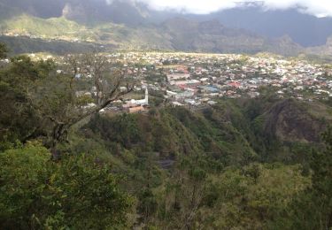
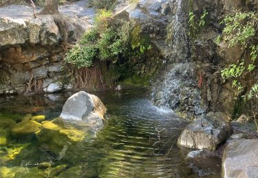
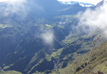
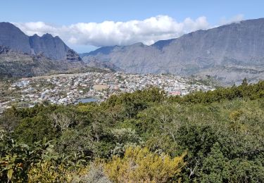
32 photos in total. Please click on a photo to see them all in the gallery.
Walking
Walking
Walking
Walking

Walking
Walking
Walking
Walking
Walking